You do not have to be logged in to donate.
If you want to use the website often please enrol (quick and free) at top right.

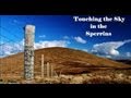
Sawel 678m, Mullaghclogha 635m, Dart Mountain 619m, Mullaghdoo 568m, Dart Mountain North-West Top 525m, Learmount Mountain South Top 492m, Learmount Mountain 489m, Meenard Mtn W Top 480m, Barnes Top 456m, Knockanbane Mountain 441m,
 Get Notifications
Walk on tracks above Glendalough
 ceadeile
Long Island: No sign of the Great Gatsby
 Fergalh
Knockree: Reasonably clear path to summit
 hibby
hibby
Circumnavigation of Tawny Rower
 glencree
Little Sugar Loaf: Windy at the top
 hibby
hibby
Near Church Mountain, Wicklow (Ireland)
Aganny Top: Approach from SW
 Colin Murphy
Keeloges-Aganny loop
 Colin Murphy
Keeloges: Go and enjoy.
 Collaborative entry
Slieve Carr: Great option for a day hike over Slieve Carr (inspired by Irish Pea
 nupat
nupat
Great option for a day hike over Slieve Carr (inspired by Irish Peaks)
Ireland's County Second Summits
 murphysw
Use of MountainViews is governed by conditions and a privacy policy.
Read general information about the site.
Opinions in material here are not necessarily endorsed by MountainViews.
Hillwalking is a risk sport. Information in comments, walks, shared GPS tracks or about starting places may not be accurate for example as regards safety or access permission. You are responsible for your safety and your permission to walk.
See the credits and list definitions.
 Visit our Facebook page.
 Length: 11.0km, Creator time taken: 4h21m, Ascent: 536m,
Descent: 541m
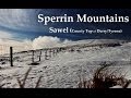
Places: Start at H5896196928, Dart Mountain North-West Top, Dart Mountain, Sawel, Learmount Mountain South Top, Learmount Mountain, end at Start
Logged as completed by 1

NOTE: ALL information such as Ascent, Length and Creator time taken etc should be regarded as approximate. The creator's comments are opinions and may not be accurate or still correct.
Your time to complete will depend on your speed plus break time and your mode of transport. For walkers: Naismith's rule, an approximate though often inaccurate estimate, suggests a time of 3h 6m + time stopped for breaks
NOTE: It is up to you to ensure that your route is appropriate for you and your party to follow bearing in mind all factors such as safety, weather conditions, experience and access permission.
* Note: A GPS Height in the elevation profile is sourced from the device that recorded the track. An "SRTM" height is derived from a model of elevations for parts of the earth. More detail![]()
|
|
|
||
| MountainViews.ie, a Hill-walking Website for the island of Ireland. 2400 Summiteers, 1480 Contributors, maintainer of lists: Arderins, Vandeleur-Lynams, Highest Hundred, County Highpoints etc | |||