Donation Request 2024
You do not have to be logged in to donate.
DONATE
Members and Supporters, the MountainViews Committee requests your help to meet the costs of the website and of other activities such as insured events or publications.You do not have to be logged in to donate.
Welcome to MountainViews
If you want to use the website often please enrol (quick and free) at top right.
If you want to use the website often please enrol (quick and free) at top right.
Overview

For more map options click on any overview map area or any detail map feature.
Detail Map Features
Find Suggested Walks
Find hill, mountain, island, coastal feature.
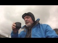
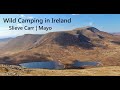
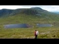
Videos

Recent Contributions
 Get Notifications
Get Notifications
Slievenamuck Ridge Walk
Duntryleague Hill: Lovely, historical walk to Darby's Bed
Raghtin More: Raghtin More
 Shamrock1
Up and down Monte Aguda, variant return via col.
 simon3
Cunnigar: Paddle or Walk?
Up and down Monte Aguda/ Esquinoza and return via beach
 simon3
An Ghráig: Longer less direct route is best
 Fergalh
Ballycurry: Success under fire
 hibby
hibby
Knockanaffrin & Knocksheegowna
Benchoona: Superb 500er
 srr45
srr45
Càrn Liath, Stob Poite Coire Ardair and Creag Meagaidh
 billbaggins
Devilsmother North Top: Big Plateau
Conditions and Info
Use of MountainViews is governed by conditions and a privacy policy.
Read general information about the site.
Opinions in material here are not necessarily endorsed by MountainViews.
Hillwalking is a risk sport. Information in comments, walks, shared GPS tracks or about starting places may not be accurate for example as regards safety or access permission. You are responsible for your safety and your permission to walk.
See the credits and list definitions.
 Visit our Facebook page.
Video display
North Mayo
Area S: Bangor Erris Hills Subarea
Place count in area: 19,
OSI/LPS Maps: 22, 23, EW-WNN
Highest place: Maumakeogh, 379m
Maximum height for area: 379 metres,
Maximum prominence for area: 294 metres,
Places in area North Mayo:
Cen: Pulathomas:Barnacuillew 260m
E: Ballycastle Hills:Knockaghaleague 237mKnockboha 186mMaumakeogh 379m
N: Benwee Head Cliffs:Benwee Head 255mBarradeegin 229mGlinsk 304mIllanmaster 238mIllanmaster Island 105mPorturlin Hill 155mSrahataggle 182mTawnaghmore 340m
S: Bangor Erris Hills:Carrafull 269mKnocklettercuss 370mKnocknascollop NW Top 244mSheean 295mSlieve Fyagh 335m
W: Belmullet:Aghaglasheen 132mTermon Hill 103m
Note: this list of places includes island features such as summits, but not islands as such.
Highest place:
Maumakeogh, 379mPlaces in area North Mayo:
Cen: Pulathomas:
Barnacuillew 260mE: Ballycastle Hills:
Knockaghaleague 237mKnockboha 186mMaumakeogh 379mN: Benwee Head Cliffs:
Benwee Head 255mBarradeegin 229mGlinsk 304mIllanmaster 238mIllanmaster Island 105mPorturlin Hill 155mSrahataggle 182mTawnaghmore 340mS: Bangor Erris Hills:
Carrafull 269mKnocklettercuss 370mKnocknascollop NW Top 244mSheean 295mSlieve Fyagh 335mW: Belmullet:
Aghaglasheen 132mTermon Hill 103mNote: this list of places includes island features such as summits, but not islands as such.

river-bank')
Bedrock type: Banded, graded and X-bedded quartzites., (Bangor/Corslieve Formation)
The Ordnance Survey Name Book gives Leitir Cos as the derivation of this name, which it interprets as 'spewy hillside of the foot'. Leitir Cos appears to be an error for Leitir Cois. Knocklettercuss is the second highest hill in the North Mayo area and the 1018th highest in Ireland.
Linkback: https://mountainviews.ie/summit/878/
COMMENTS for Knocklettercuss (Leitir Cois) 1 of 1  Follow this place's comments

|
|
|
|
||
| MountainViews.ie, a Hill-walking Website for the island of Ireland. 2400 Summiteers, 1480 Contributors, maintainer of lists: Arderins, Vandeleur-Lynams, Highest Hundred, County Highpoints etc | |||