Members and Supporters, the MountainViews Committee requests your help to meet the costs of the website and of other activities such as insured events or publications.
Sperrin MountainsArea, NE: Glenshane South
Subarea
Feature count in area: 64, by county: Derry: 34, Tyrone: 39, of which 9 are in both Derry and Tyrone,
OSI/LPS Maps: 12, 13, 6, 7, 8
Highest Place: Sawel 678m
Starting Places (21) in area Sperrin Mountains: Altinure Road, Banagher Glen Nature Reserve, Barnes Gap Car Park, Crocknakin, Drumnaspar Picnic CP, Glenchiel Road, Glenedra Bridge, Glenelly Road, Parkreagh, Goles Road, Lough Ouske, Moneyneany Village, Moydamlaght Forest, Moydamlaght Road, Mullaghmore, Mullaghbane, Spaltindoagh, Sperrin Hamlet, Sperrin Heritage Centre, Sperrin Heritage Centre W, Sperrin Road, Barnes Top, Sperrin Road, Glashagh Bridge, Sperrin Road, Sperrin
Summits & other features in area Sperrin Mountains: E: Magherafelt Hills: Slieve Gallion NE Top 493.6m E: Magherafelt Hills: Slieve Gallion 526.6m N: Claudy Hills: Crockdooish 321m, Curradrolan Hill 270m, Eglish 277m, Letterlogher 249m, Mullaghmeash Hill 244m, Slieveboy 259m, Straid Hill 303m NE Cen: Glenelly North East: Barnes Top 456m, Craigagh Hill 460m, Crockbrack 526.1m, Knockanbane Mountain 441m, Meenard Mountain 620m, Meenard Mtn W Top 480m, Mullaghaneany 627m, Mullaghash 480m, Mullaghsallagh 485m, Oughtmore 569m, Spelhoagh 568m NE: Glenshane North: Benbradagh 465m, Boviel Top 454m, Carn Hill 448m, Carntogher 464m, Moneyoran Hill 414m NE: Glenshane South: Bohilbreaga 478m, Coolnasillagh Mountain 423m, Corick Mountain 430m, Crockalougha 407m, Mullaghmore 550m, White Mountain 537m NW Cen: Glenelly North West: Dart Mountain 619m, Dart Mountain North-West Top 525m, Learmount Mountain 489m, Learmount Mountain South Top 492m, Mullaghasturrakeen 581m, Mullaghcarbatagh 517m, Mullaghclogha 635m, Mullaghclogher 572m, Mullaghdoo 568m, Sawel 678m NW: Maheramason Hills: Clondermot Hill 220m, Gortmonly Hill 218m, Slievekirk 370m SE Cen: Glenelly South East: Carnanelly 562m, Carnanelly West Top 503.4m, Mullaghbane 467m, Mullaghturk 416m SE: Cookstown Hills: Cregganconroe 300m, Fir Mountain 362m, Oughtmore 382m SW Cen: Glenelly South West: Clogherny Top 408m, Craignamaddy 385m, Crocknamoghil 335m, Mullaghbolig 442m, Spaltindoagh 420m SW: Mullaghcarn: Curraghchosaly Mountain 416m, Mullaghcarn 542m, Mullaghcarn South Top 525m SW: Newtownstewart Hills: Bessy Bell 420m, Mullaghcroy 242m W: Strabane: Balix Hill 403m, Knockavoe 296m, Owenreagh Hill 400m
Note: this list of places may include island features such as summits, but not
islands as such.
Corick Mountain, 430mHill Cnoc an Chomraic A name in Irish,
Place Rating ..
(poss. Ir. ‡Cnoc an Chomhraic [PDT], 'hill of the combat'), Derry County in Ulster province, in Carn Lists, Corick Mountain is the 802nd highest place in Ireland.
Grid Reference C76100 03700,
OS 1:50k mapsheet 8 Place visited by: 36members, recently by: Colin Murphy, Paddym99, garybuz, Sperrinwalker, Kilcoobin, eamonoc, David-Guenot, Fergalh, LorraineG60, LorraineG, trostanite, MichaelG55, Ulsterpooka, seanc15, simoburn
I visited this place: NO (You need to be a logged-in member for this.)
Short or GPS IDs, 6 char: Crc430, 10 char: CrckMntn Linkback: https://mountainviews.ie/summit/688/
Gallery for Corick Mountain (Cnoc an Chomraic) and surrounds
Summary
for Corick Mountain (Cnoc an Chomraic):
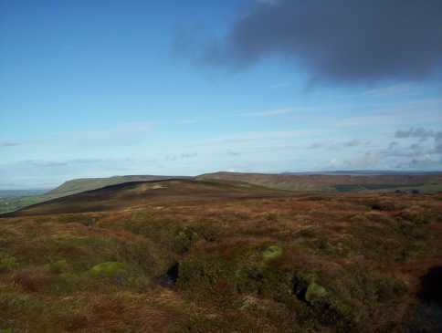
Unremarkable top and a bit of a slog
Summary created by Colin Murphy
2023-04-24 15:00:42
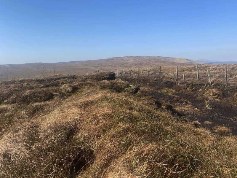
Picture: Summit area
There is parking for several cars at the entrance to the Glenshane Forest at A (C77643 04324). Walk SW down track (losing about 30m elevation) before turning NW across the Roe River at B (C77128 03821). Continue along this track for about 700m, cross gate and turn left (west) up a steepish, grassy slope with forest on the left. You will have to work your way around a couple of trees, but will eventually emerge onto open hillside at C (C76575 04256) after about 500m. The remainder of the 800m climb to the SW is somewhat of a slog up through heather to the summit area next to a fence/ditch, but otherwise unmarked.
Topped Corrick one cool Sunday morning in January last year as part of a circuit that took in White Mt, Bohilbreaga, over Craig-na-Shoke cliffs and on to Mullaghmore. Walk from White Mtn to Corrick is across heavy, boggy ground but some great views across Glenshane towards Carntogher, Carn Hill and as the picture shows along Corrick's length towards Benbradagh's sheer western end. Corrick , overlooking the Glenshane pass, is itself very wet and boggy even on the driest of days. Linkback: mountainviews.ie/summit/688/comment/2873/
Read Less
Read More
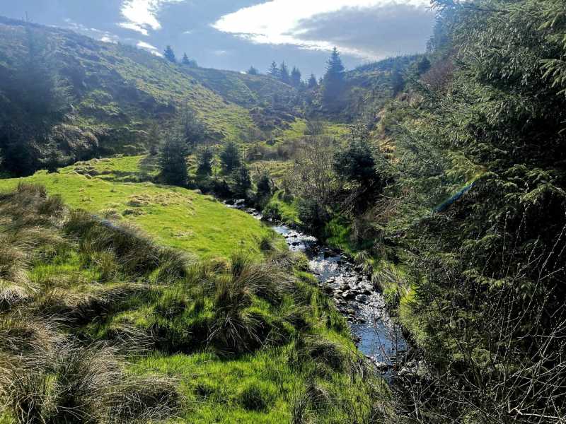
Picture: The Roe River
Going with the stream
by Colin Murphy
24 Apr 2023
This hill offered little in the way of views, although when I did it on a cloudless spring day, the walk was enlivened by a couple of streams and the Roe River snaking it's way northwards. Linkback: mountainviews.ie/summit/688/comment/23931/
Use of MountainViews is governed by conditions and a privacy policy.
Read general information about the site. Opinions in material here are not necessarily endorsed by MountainViews.
Hillwalking is a risk sport. Information in comments, walks, shared GPS tracks or about starting places may
not be accurate for example as regards safety or access permission. You are responsible for your safety and your permission to walk.
See the credits and list definitions.


 Our Facebook page.