Donation Request 2024
You do not have to be logged in to donate.
DONATE
Members and Supporters, the MountainViews Committee requests your help to meet the costs of the website and of other activities such as insured events or publications.You do not have to be logged in to donate.
Welcome to MountainViews
If you want to use the website often please enrol (quick and free) at top right.
If you want to use the website often please enrol (quick and free) at top right.
Overview

For more map options click on any overview map area or any detail map feature.
Detail Map Features
Showing 10 items:
Ballycurragh Hill 536m, Carrickashane Mountain 508m, Ballyteige 447m,
2385, 32km
2450, 24km
2686, 21km
4508, 19km
3299, 18km
3627, 12km
4000, 5km
Ballycurragh Hill 536m, Carrickashane Mountain 508m, Ballyteige 447m,
Tracks:
Find Suggested Walks
Find hill, mountain, island, coastal feature.
Videos

Recent Contributions
 Get Notifications
Get Notifications
Lobawn Loop - Clockwise avoids any steep ascent! Easy stream crossing.
Walk on tracks above Glendalough
 ceadeile
Long Island: No sign of the Great Gatsby
 Fergalh
Knockree: Reasonably clear path to summit
 hibby
hibby
Circumnavigation of Tawny Rower
 glencree
Little Sugar Loaf: Windy at the top
 hibby
hibby
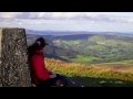
Near Church Mountain, Wicklow (Ireland)
Aganny Top: Approach from SW
 Colin Murphy
Keeloges-Aganny loop
 Colin Murphy
Keeloges: Go and enjoy.
 Collaborative entry
Slieve Carr: Great option for a day hike over Slieve Carr (inspired by Irish Pea
 nupat
nupat
Great option for a day hike over Slieve Carr (inspired by Irish Peaks)
Conditions and Info
Use of MountainViews is governed by conditions and a privacy policy.
Read general information about the site.
Opinions in material here are not necessarily endorsed by MountainViews.
Hillwalking is a risk sport. Information in comments, walks, shared GPS tracks or about starting places may not be accurate for example as regards safety or access permission. You are responsible for your safety and your permission to walk.
See the credits and list definitions.
 Visit our Facebook page.
Video display
Wicklow
Area S: Croaghanmoira Subarea
Place count in area: 115,
OSI/LPS Maps: 28B, 55, 56, 61, 62, AWW, EW-DM, EW-LG, EW-WE, EW-WS
Highest place: Lugnaquilla, 924.7m
Maximum height for area: 924.7 metres,
Maximum prominence for area: 905 metres,
Places in area Wicklow:
Cen: Glendalough North:Brockagh Mountain 556.9mBrockagh Mountain NW Top 549.5mBrockagh Mountain SE Top 471.7mCamaderry East Top 677.3mCamaderry Mountain 698.6mConavalla 734mTomaneena 682.4m
Cen: Glendalough South:Carriglineen Mountain 456.6mCullentragh Mountain 510mDerrybawn Mountain 476.1mKirikee Mountain 474.5mLugduff 653.2mLugduff SE Top 638mMullacor 660.7mTrooperstown Hill 430m
N Cen: Tonelagee:Carrignagunneen 561mFair Mountain 571.2mStoney Top 713.7mTonelagee 815.8mTonelagee E Top 668mTonelagee South-East Top 545.8m
NE: Bray & Kilmacanogue:Bray Head Hill 238.9mCarrigoona Commons East 242mDowns Hill 372.9mGreat Sugar Loaf 501.2mLittle Sugar Loaf 342.4m
NE: Djouce:Djouce 725.5mKnockree 342.1mMaulin 570mTonduff 642mTonduff East Top 593mWar Hill 684.8mWhite Hill 631.1m
NE: Fancy:Ballinafunshoge 480mKanturk 527.4mKnocknacloghoge 532.4mLuggala 593.3mRobber's Pass Hill 508.9mScarr 640mScarr North-West Top 559.8mSleamaine 430m
NE: Vartry:Ballinacorbeg 336mBallycurry 301mDunranhill 342mMount Kennedy 365.9m
NW: Blessington:Carrigleitrim 408mLugnagun 446.2mSlieveroe 332mSorrel Hill 599.5m
NW: Mullaghcleevaun:Black Hill 602.2mCarrigshouk 572.5mCarrigvore 682.4mDuff Hill 720.8mGravale 719mMoanbane 703mMullaghcleevaun 846.7mMullaghcleevaun East Top 796mSilsean 698m
S: Aughrim Hills:Cushbawn 400mKilleagh 249mMoneyteige North 427mPreban Hill 389m
S: Croaghanmoira:Ballinacor Mountain 529.3mBallycurragh Hill 536mBallyteige 447mCarrickashane Mountain 508mCroaghanmoira 662.3mCroaghanmoira North Top 579.5mFananierin 426mSlieve Maan 547.8mSlieve Maan North Top 546.1m
S: Croghan Kinsella:Annagh Hill 454mCroghan Kinsella 606mCroghan Kinsella East Top 562.1mSlievefoore 414m
S: Shillelagh Hills:Lakeen 357mMonaughrim 206mSeskin 344mStookeen 420m
S: Tinahely Hills:Ballycumber Hill 429.7mEagle Hill 296mMuskeagh Hill 398.2m
SE: Wicklow South East:Ballinastraw 284mBallyguile Hill 188mBarranisky 280mCarrick Mountain 381mCollon Hill 238mKilnamanagh Hill 217mWestaston Hill 270m
W: Baltinglass:Ballyhook Hill 288mBaltinglass Hill 382mCarrig Mountain 571mCarrigeen Hill 298mCloghnagaune 385mCorballis Hill 258mKeadeen Mountain 653mSpinans Hill 409mSpinans Hill SE Top 400mTinoran Hill 312m
W: Cen Lugnaquilla:Ballineddan Mountain 652.3mBenleagh 689mCamenabologue 758mCamenabologue SE Top 663mCloghernagh 800mCorrigasleggaun 794.6mLugnaquilla 924.7mSlievemaan 759.7m
W: Donard:Brewel Hill 222mChurch Mountain 544mCorriebracks 531mLobawn 636mSlievecorragh 418mSugarloaf 552mTable Mountain 701.7mTable Mountain West Top 563m
Note: this list of places includes island features such as summits, but not islands as such.
Highest place:
Lugnaquilla, 924.7mPlaces in area Wicklow:
Cen: Glendalough North:
Brockagh Mountain 556.9mBrockagh Mountain NW Top 549.5mBrockagh Mountain SE Top 471.7mCamaderry East Top 677.3mCamaderry Mountain 698.6mConavalla 734mTomaneena 682.4mCen: Glendalough South:
Carriglineen Mountain 456.6mCullentragh Mountain 510mDerrybawn Mountain 476.1mKirikee Mountain 474.5mLugduff 653.2mLugduff SE Top 638mMullacor 660.7mTrooperstown Hill 430mN Cen: Tonelagee:
Carrignagunneen 561mFair Mountain 571.2mStoney Top 713.7mTonelagee 815.8mTonelagee E Top 668mTonelagee South-East Top 545.8mNE: Bray & Kilmacanogue:
Bray Head Hill 238.9mCarrigoona Commons East 242mDowns Hill 372.9mGreat Sugar Loaf 501.2mLittle Sugar Loaf 342.4mNE: Djouce:
Djouce 725.5mKnockree 342.1mMaulin 570mTonduff 642mTonduff East Top 593mWar Hill 684.8mWhite Hill 631.1mNE: Fancy:
Ballinafunshoge 480mKanturk 527.4mKnocknacloghoge 532.4mLuggala 593.3mRobber's Pass Hill 508.9mScarr 640mScarr North-West Top 559.8mSleamaine 430mNE: Vartry:
Ballinacorbeg 336mBallycurry 301mDunranhill 342mMount Kennedy 365.9mNW: Blessington:
Carrigleitrim 408mLugnagun 446.2mSlieveroe 332mSorrel Hill 599.5mNW: Mullaghcleevaun:
Black Hill 602.2mCarrigshouk 572.5mCarrigvore 682.4mDuff Hill 720.8mGravale 719mMoanbane 703mMullaghcleevaun 846.7mMullaghcleevaun East Top 796mSilsean 698mS: Aughrim Hills:
Cushbawn 400mKilleagh 249mMoneyteige North 427mPreban Hill 389mS: Croaghanmoira:
Ballinacor Mountain 529.3mBallycurragh Hill 536mBallyteige 447mCarrickashane Mountain 508mCroaghanmoira 662.3mCroaghanmoira North Top 579.5mFananierin 426mSlieve Maan 547.8mSlieve Maan North Top 546.1mS: Croghan Kinsella:
Annagh Hill 454mCroghan Kinsella 606mCroghan Kinsella East Top 562.1mSlievefoore 414mS: Shillelagh Hills:
Lakeen 357mMonaughrim 206mSeskin 344mStookeen 420mS: Tinahely Hills:
Ballycumber Hill 429.7mEagle Hill 296mMuskeagh Hill 398.2mSE: Wicklow South East:
Ballinastraw 284mBallyguile Hill 188mBarranisky 280mCarrick Mountain 381mCollon Hill 238mKilnamanagh Hill 217mWestaston Hill 270mW: Baltinglass:
Ballyhook Hill 288mBaltinglass Hill 382mCarrig Mountain 571mCarrigeen Hill 298mCloghnagaune 385mCorballis Hill 258mKeadeen Mountain 653mSpinans Hill 409mSpinans Hill SE Top 400mTinoran Hill 312mW: Cen Lugnaquilla:
Ballineddan Mountain 652.3mBenleagh 689mCamenabologue 758mCamenabologue SE Top 663mCloghernagh 800mCorrigasleggaun 794.6mLugnaquilla 924.7mSlievemaan 759.7mW: Donard:
Brewel Hill 222mChurch Mountain 544mCorriebracks 531mLobawn 636mSlievecorragh 418mSugarloaf 552mTable Mountain 701.7mTable Mountain West Top 563mNote: this list of places includes island features such as summits, but not islands as such.

Bedrock type: Dark blue-grey slate, phyllite & schist, (Maulin Formation)
Ballyteige is the 743rd highest place in Ireland.
Linkback: https://mountainviews.ie/summit/630/
COMMENTS for Ballyteige 1 2 Next page >>  Follow this place's comments

|
|
|
|
||
| MountainViews.ie, a Hill-walking Website for the island of Ireland. 2400 Summiteers, 1480 Contributors, maintainer of lists: Arderins, Vandeleur-Lynams, Highest Hundred, County Highpoints etc | |||