Donation Request 2024
You do not have to be logged in to donate.
DONATE
Members and Supporters, the MountainViews Committee requests your help to meet the costs of the website and of other activities such as insured events or publications.You do not have to be logged in to donate.
Welcome to MountainViews
If you want to use the website often please enrol (quick and free) at top right.
If you want to use the website often please enrol (quick and free) at top right.
Overview

For more map options click on any overview map area or any detail map feature.
Detail Map Features
Showing 18 of a total of 22 items:
Mweelrea 814m, Ben Lugmore 803m, Ben Bury 795m, Ben Lugmore East Top 790m, Ben Lugmore West Top 790m, Barrclashcame North-West Top 580m, Mweelrea SE Spur 495m, Teevnabinnia 379m,
2729, 28km
3075, 19km
4220, 18km
4999, 17km
4105, 16km
3357, 15km
3579, 13km
1999, 13km
2903, 12km
3853, 10km
Mweelrea 814m, Ben Lugmore 803m, Ben Bury 795m, Ben Lugmore East Top 790m, Ben Lugmore West Top 790m, Barrclashcame North-West Top 580m, Mweelrea SE Spur 495m, Teevnabinnia 379m,
Tracks:
Find Suggested Walks
Find hill, mountain, island, coastal feature.
Videos
Recent Contributions
 Get Notifications
Get Notifications
Westtown Hill: Tramore's Highest Point
 DeirdreM
Lobawn Loop - Clockwise avoids any steep ascent! Easy stream crossing.
Knockbrinnea West Top: Eflanagan on the Knockbrinneas
 eflanaga
Cunnigar: Short trek to summit
 Fergalh
Knockbrinnea West Top: Larger Twin
 Collaborative entry
Walk on tracks above Glendalough
 ceadeile
Knockaunanattin West Top: Views, loughs and a navigational aid.
 simon3
Circumnavigation of Tawny Rower
 glencree
Knockaunanattin West Top: First step to Stumpa Duloigh
 Collaborative entry
Ascending the Knockbrinneas from the north.
 simon3
Knockaunanattin West Top: Impressive defile start leads to airy ridgeline.
 Peter Walker
Near Church Mountain, Wicklow (Ireland)
Conditions and Info
Use of MountainViews is governed by conditions and a privacy policy.
Read general information about the site.
Opinions in material here are not necessarily endorsed by MountainViews.
Hillwalking is a risk sport. Information in comments, walks, shared GPS tracks or about starting places may not be accurate for example as regards safety or access permission. You are responsible for your safety and your permission to walk.
See the credits and list definitions.
 Visit our Facebook page.
Video display
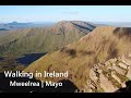
Mweelrea
Area W: Mweelrea Subarea
Place count in area: 12,
OSI/LPS Maps: 37, EW-CON, MSW
Highest place: Mweelrea, 814m
Maximum height for area: 814 metres,
Maximum prominence for area: 779 metres,
Places in area Mweelrea:
E: Ben Gorm Mountains:Ben Creggan 693mBen Creggan South Top 687mBen Gorm 700m
W: Mweelrea:Ben Bury 795mBen Lugmore 803mBen Lugmore East Top 790mBen Lugmore West Top 790mCorrymailley Hill 286mMweelrea 814mMweelrea SE Spur 495mTawnydoogan 312mTeevnabinnia 379m
Note: this list of places includes island features such as summits, but not islands as such.
Highest place:
Mweelrea, 814mPlaces in area Mweelrea:
E: Ben Gorm Mountains:
Ben Creggan 693mBen Creggan South Top 687mBen Gorm 700mW: Mweelrea:
Ben Bury 795mBen Lugmore 803mBen Lugmore East Top 790mBen Lugmore West Top 790mCorrymailley Hill 286mMweelrea 814mMweelrea SE Spur 495mTawnydoogan 312mTeevnabinnia 379mNote: this list of places includes island features such as summits, but not islands as such.

Bedrock type: Sandstone & conglomerate, ignimbrite, (Mweelrea Formation)
Ben Lugmore East Top is the 52nd highest place in Ireland.
Linkback: https://mountainviews.ie/summit/51/
COMMENTS for Ben Lugmore East Top (Binn an Loig Mhóir (mullach thoir)) 1 2 Next page >>  Follow this place's comments

|
|
|
|
||
| MountainViews.ie, a Hill-walking Website for the island of Ireland. 2400 Summiteers, 1480 Contributors, maintainer of lists: Arderins, Vandeleur-Lynams, Highest Hundred, County Highpoints etc | |||