Donation Request 2024
You do not have to be logged in to donate.
DONATE
Members and Supporters, the MountainViews Committee requests your help to meet the costs of the website and of other activities such as insured events or publications.You do not have to be logged in to donate.
Welcome to MountainViews
If you want to use the website often please enrol (quick and free) at top right.
If you want to use the website often please enrol (quick and free) at top right.
Overview

For more map options click on any overview map area or any detail map feature.
Detail Map Features
Showing 9 items:
Moanlaur 566m, Knockmore 565m, Beenduff 515m, Emlagh 483m, Lack Mountain 465m, Knockbrack 459m,
3940, 19km
3681, 12km
2635, 4km
Moanlaur 566m, Knockmore 565m, Beenduff 515m, Emlagh 483m, Lack Mountain 465m, Knockbrack 459m,
Tracks:
Find Suggested Walks
Find hill, mountain, island, coastal feature.
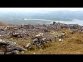
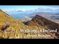
Videos


Recent Contributions
 Get Notifications
Get Notifications
Lobawn Loop - Clockwise avoids any steep ascent! Easy stream crossing.
Walk on tracks above Glendalough
 ceadeile
Long Island: No sign of the Great Gatsby
 Fergalh
Knockree: Reasonably clear path to summit
 hibby
hibby
Circumnavigation of Tawny Rower
 glencree
Little Sugar Loaf: Windy at the top
 hibby
hibby
Near Church Mountain, Wicklow (Ireland)
Aganny Top: Approach from SW
 Colin Murphy
Keeloges-Aganny loop
 Colin Murphy
Keeloges: Go and enjoy.
 Collaborative entry
Slieve Carr: Great option for a day hike over Slieve Carr (inspired by Irish Pea
 nupat
nupat
Great option for a day hike over Slieve Carr (inspired by Irish Peaks)
Conditions and Info
Use of MountainViews is governed by conditions and a privacy policy.
Read general information about the site.
Opinions in material here are not necessarily endorsed by MountainViews.
Hillwalking is a risk sport. Information in comments, walks, shared GPS tracks or about starting places may not be accurate for example as regards safety or access permission. You are responsible for your safety and your permission to walk.
See the credits and list definitions.
 Visit our Facebook page.
Video display
Slieve Mish
Area W: Aughils Subarea
Place count in area: 16,
OSI/LPS Maps: 71, EW-DC, EW-DE
Highest place: Baurtregaum, 849.7m
Maximum height for area: 849.7 metres,
Maximum prominence for area: 643 metres,
Places in area Slieve Mish:
Cen: Baurtregaum:Baurtregaum 849.7mBaurtregaum Far NE Top 601.2mBaurtregaum NE Top 818.5mBaurtregaum NW Top 723mCaherconree 835mCastle Hill 600mGearhane 792m
E: Barnanageehy:Barnanageehy 561m
W: Aughils:Beenduff 515mCaherbla 585.2mEmlagh 483mKnockbrack 459mKnockmore 565mLack Mountain 465mMoanlaur 566m
W: Camp:Corrin 332m
Note: this list of places includes island features such as summits, but not islands as such.
Highest place:
Baurtregaum, 849.7mPlaces in area Slieve Mish:
Cen: Baurtregaum:
Baurtregaum 849.7mBaurtregaum Far NE Top 601.2mBaurtregaum NE Top 818.5mBaurtregaum NW Top 723mCaherconree 835mCastle Hill 600mGearhane 792mE: Barnanageehy:
Barnanageehy 561mW: Aughils:
Beenduff 515mCaherbla 585.2mEmlagh 483mKnockbrack 459mKnockmore 565mLack Mountain 465mMoanlaur 566mW: Camp:
Corrin 332mNote: this list of places includes island features such as summits, but not islands as such.

Bedrock type: Aeolian sandstone, (Kilmurry Sandstone Formation)
Beenduff is the 522nd highest place in Ireland. Beenduff is the second most southerly summit and also the second most westerly in the Slieve Mish area.
Linkback: https://mountainviews.ie/summit/422/
COMMENTS for Beenduff (An Bhinn Dubh) 1 of 1  Follow this place's comments

|
|
|
|
||
| MountainViews.ie, a Hill-walking Website for the island of Ireland. 2400 Summiteers, 1480 Contributors, maintainer of lists: Arderins, Vandeleur-Lynams, Highest Hundred, County Highpoints etc | |||