Donation Request 2024
You do not have to be logged in to donate.
DONATE
Members and Supporters, the MountainViews Committee requests your help to meet the costs of the website and of other activities such as insured events or publications.You do not have to be logged in to donate.
Welcome to MountainViews
If you want to use the website often please enrol (quick and free) at top right.
If you want to use the website often please enrol (quick and free) at top right.
Overview

For more map options click on any overview map area or any detail map feature.
Detail Map Features
Showing 20 of a total of 28 items:
Brandon 951.7m, Brandon North Top 895.4m, Brandon Far North Top 840.1m, Brandon Peak 840m, Benagh 822.5m, Faha Ridge 809.2m, Brandon South Top 790m, Masatiompan 761.9m, Pierasmore 745.7m, Pierasmore North Top 700m,
3927, 20km
3911, 18km
1848, 17km
2873, 16km
3188, 16km
4148, 15km
4249, 14km
4335, 11km
3189, 11km
1104, 11km
Brandon 951.7m, Brandon North Top 895.4m, Brandon Far North Top 840.1m, Brandon Peak 840m, Benagh 822.5m, Faha Ridge 809.2m, Brandon South Top 790m, Masatiompan 761.9m, Pierasmore 745.7m, Pierasmore North Top 700m,
Tracks:
Find Suggested Walks
Find hill, mountain, island, coastal feature.
Videos


Recent Contributions
 Get Notifications
Get Notifications
Cunnigar: Short trek to summit
 Fergalh
Westtown Hill: Tramore's Highest Point
 DeirdreM
Lobawn Loop - Clockwise avoids any steep ascent! Easy stream crossing.
Knockbrinnea West Top: Eflanagan on the Knockbrinneas
 eflanaga
Knockbrinnea West Top: Larger Twin
 Collaborative entry
Walk on tracks above Glendalough
 ceadeile
Ascending the Knockbrinneas from the north.
 simon3
Knockaunanattin West Top: Views, loughs and a navigational aid.
 simon3
Circumnavigation of Tawny Rower
 glencree
Knockaunanattin West Top: First step to Stumpa Duloigh
 Collaborative entry
Knockaunanattin West Top: Impressive defile start leads to airy ridgeline.
 Peter Walker
Near Church Mountain, Wicklow (Ireland)
Conditions and Info
Use of MountainViews is governed by conditions and a privacy policy.
Read general information about the site.
Opinions in material here are not necessarily endorsed by MountainViews.
Hillwalking is a risk sport. Information in comments, walks, shared GPS tracks or about starting places may not be accurate for example as regards safety or access permission. You are responsible for your safety and your permission to walk.
See the credits and list definitions.
 Visit our Facebook page.
Video display
Brandon Group
Area Cen: Faha Ridge Subarea
Place count in area: 15,
OSI/LPS Maps: 70, EW-DC, EW-DW
Highest place: Brandon, 951.7m
Maximum height for area: 951.7 metres,
Maximum prominence for area: 934 metres,
Places in area Brandon Group:
Cen: Faha Ridge:Benagh 822.5mFaha Ridge 809.2m
N: Brandon Point:Faill an tSáis 430.7m
N: Brandon Ridge North:Brandon Far North Top 840.1mBrandon North Top 895.4mMasatiompan 761.9mPierasmore North Top 700mPierasmore 745.7m
S: Ballysitteragh:An Bhinn Dubh 479.2mBallysitteragh 623mBeennabrack 608.5m
S: Brandon Ridge South:Gearhane 803mBrandon Peak 840mBrandon 951.7mBrandon South Top 790m
Note: this list of places includes island features such as summits, but not islands as such.
Highest place:
Brandon, 951.7mPlaces in area Brandon Group:
Cen: Faha Ridge:
Benagh 822.5mFaha Ridge 809.2mN: Brandon Point:
Faill an tSáis 430.7mN: Brandon Ridge North:
Brandon Far North Top 840.1mBrandon North Top 895.4mMasatiompan 761.9mPierasmore North Top 700mPierasmore 745.7mS: Ballysitteragh:
An Bhinn Dubh 479.2mBallysitteragh 623mBeennabrack 608.5mS: Brandon Ridge South:
Gearhane 803mBrandon Peak 840mBrandon 951.7mBrandon South Top 790mNote: this list of places includes island features such as summits, but not islands as such.

Bedrock type: Rhythmically bedded sandstone, (Ballymore Sandstone Formation)
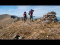
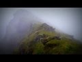
This is the airy arete located west of Benagh promontory fort. It drops steeply to the south into Com an Chnoic, and even more abruptly to the north into Coimín na gCnámh. Previously Brandon Mtn North East Top in MV. Na Poirt is the 36th highest place in Ireland.
Linkback: https://mountainviews.ie/summit/35/
COMMENTS for Faha Ridge (Na Poirt) 1 2 Next page >>  Follow this place's comments

|
|
|
|
||
| MountainViews.ie, a Hill-walking Website for the island of Ireland. 2400 Summiteers, 1480 Contributors, maintainer of lists: Arderins, Vandeleur-Lynams, Highest Hundred, County Highpoints etc | |||