Donation Request 2024
You do not have to be logged in to donate.
DONATE
Members and Supporters, the MountainViews Committee requests your help to meet the costs of the website and of other activities such as insured events or publications.You do not have to be logged in to donate.
Welcome to MountainViews
If you want to use the website often please enrol (quick and free) at top right.
If you want to use the website often please enrol (quick and free) at top right.
Overview

For more map options click on any overview map area or any detail map feature.
Detail Map Features
Showing 1 items:
Crocknaneeve 155.9m,
Crocknaneeve 155.9m,
Find Suggested Walks
Find hill, mountain, island, coastal feature.
Videos
Recent Contributions
 Get Notifications
Get Notifications
Westtown Hill: Tramore's Highest Point
 DeirdreM
Lobawn Loop - Clockwise avoids any steep ascent! Easy stream crossing.
Knockbrinnea West Top: Eflanagan on the Knockbrinneas
 eflanaga
Cunnigar: Short trek to summit
 Fergalh
Knockbrinnea West Top: Larger Twin
 Collaborative entry
Walk on tracks above Glendalough
 ceadeile
Knockaunanattin West Top: Views, loughs and a navigational aid.
 simon3
Circumnavigation of Tawny Rower
 glencree
Knockaunanattin West Top: First step to Stumpa Duloigh
 Collaborative entry
Ascending the Knockbrinneas from the north.
 simon3
Knockaunanattin West Top: Impressive defile start leads to airy ridgeline.
 Peter Walker
Near Church Mountain, Wicklow (Ireland)
Conditions and Info
Use of MountainViews is governed by conditions and a privacy policy.
Read general information about the site.
Opinions in material here are not necessarily endorsed by MountainViews.
Hillwalking is a risk sport. Information in comments, walks, shared GPS tracks or about starting places may not be accurate for example as regards safety or access permission. You are responsible for your safety and your permission to walk.
See the credits and list definitions.
 Visit our Facebook page.
Video display
Donegal NW
Area N: Gweedore Subarea
Place count in area: 8,
OSI/LPS Maps: 1, 10, 11
Highest place: Tievealehid, 429m
Maximum height for area: 429 metres,
Maximum prominence for area: 304 metres,
Places in area Donegal NW:
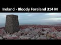
N: Gweedore:Moylemore (Owey Island) 102mCarntreena 425mBloody Foreland 314mCrocknaneeve 155.9mTievealehid 429m
S: Trawenagh:Croaghegly 245mTrusklieve 175m
W: Arranmore:Cluidaniller West Top (Aranmore) 227m
Note: this list of places includes island features such as summits, but not islands as such.
Highest place:
Tievealehid, 429mPlaces in area Donegal NW:
N: Gweedore:
Moylemore (Owey Island) 102mCarntreena 425mBloody Foreland 314mCrocknaneeve 155.9mTievealehid 429mS: Trawenagh:
Croaghegly 245mTrusklieve 175mW: Arranmore:
Cluidaniller West Top (Aranmore) 227mNote: this list of places includes island features such as summits, but not islands as such.

Bedrock type: Whitish quarztite with pebble beds, (Ards Quartzite Formation)
Cnoc na Naomh is the 1464th highest place in Ireland. Cnoc na Naomh is the second most northerly summit and also the second most easterly in the Donegal NW area.
Linkback: https://mountainviews.ie/summit/1343/
COMMENTS for Crocknaneeve (Cnoc na Naomh) 1 of 1  Follow this place's comments

|
|
|
|
||
| MountainViews.ie, a Hill-walking Website for the island of Ireland. 2400 Summiteers, 1480 Contributors, maintainer of lists: Arderins, Vandeleur-Lynams, Highest Hundred, County Highpoints etc | |||