Routecard The Glover Highlander

Routecard The Glover Highlander
BACK TO CHALLENGE WALK CALENDAR

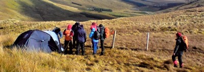
Starting at Muckish mountain and traversing the Derryveagh Mountains so as to finish with Errigal Mountain - the walk potters over hard rock, soft bog and indeed grassy marsh. In between these two spectacular mountains is a wondrous traverse of enchanting loughs with views of lonely valleys and islands that herald the great Atlantic.
1. Start Glover Highlander IC 01597 31344 95 m
2. The Miners Path IB 99876 29055 350 m
3. Muckish IC 00448 28709 667 m
4. An Mhucais Ridge IB 99809 27993 623 m
5. Gleennaneor Ridge IB 99904 27348 351 m
6. Gleennaneor IB 99904 26824 242 m
7. Lough Dog Way IB 98691 25806 445 m
8. Na Leargacha IB 98443 26178 471 m
9. Ballyness IB 97090 25613 295 m
10. Eachla Bheag Way IB 96583 25143 350 m
11. Aghla Beg IB 96156 25295 564 m
12. Aghla Beg South IB 96590 24670 603 m
13. Lough Fiáin IB 95591 23921 450 m
14. Aghla More IB 94976 23934 584 m
15. Altan Tower IB 95379 22639 145 m
16. Beaghy IB 94620 22225 395 m
17. Mac Uchta Way IB 94580 21676 350 m
18. Mackoght IB 94017 21474 555 m
19. Errigal Track IB 93477 20522 520 m
20. Errigal IB 92827 20779 751 m
21. Glover Finish IB 94291 19740 225m
N.B. Always remember that whilst GPS is an exellent tool it should never be substituted for competent navigational skills. Many of the above waypoints have been amassed by myself over the years and named by using their closest features on various accepted maps, but may not be the best given route that the day may dictate. In good visibility your walking route will be a whole lot more obvious and arc and flow neatly. However in thick mist (or even snow storms) the above waypoints are where I personally feel I need to be so as to keep safe and sound. It is important to note however that at times the route between two waypoints may be more of an arc than a straight line.
As with all Challenge Walks one should always ensure to have their "homework" done so as to allow for a safe enjoyable day. . . After all . . . . "accidents don't happen by accident".

Keep Safe and enjoy your day!